Extent Tab
Project Records
Extent refers to geographic boundaries for your project. Spatial extents lets users see at a glance the geographic footprint of your project and allows searching within specific geographic areas.
Extent Tab
| Metadata Field | Project Records |
|---|---|
| Extent | Required |
Creating Extents
There are multiple ways to create a spatial extent for your project.
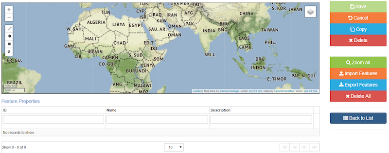
Clicking the Edit Extent Features button allows for the addition of Feature Properties such as: ID, Name, or Description. You can draw a polygon or a bounding box in the initial window.
You can export spatial extents and re-use for other records using the import feature button or by dragging and dropping onto the map.
Extents are limited to 5000 vertices. Recommend you create only simple polygons or bounding boxes. If you want greater detail, attach high-definition shapefiles instead of trying to draw them.
Extents should be accurate enough for searching purposes, but remember that they are metadata, not data.
Option 1: Import Spatial Features
Spatial features such as geoJSON, shapefiles, and kml can be imported. However, file attributes (such as name and description), will not be imported and must be added manually.
For projects without a specific extent, you can use the FWS regional geography. Projects should have custom extents when it is relevant to the scope of the project. Remember, these extents will be used for search and discovery purposes. geoJSON files for all FWS regional and state geographies are available on ScienceBase (private DMWG folder that requires ScienceBase login). Download the relevant files and then import into mdEditor.
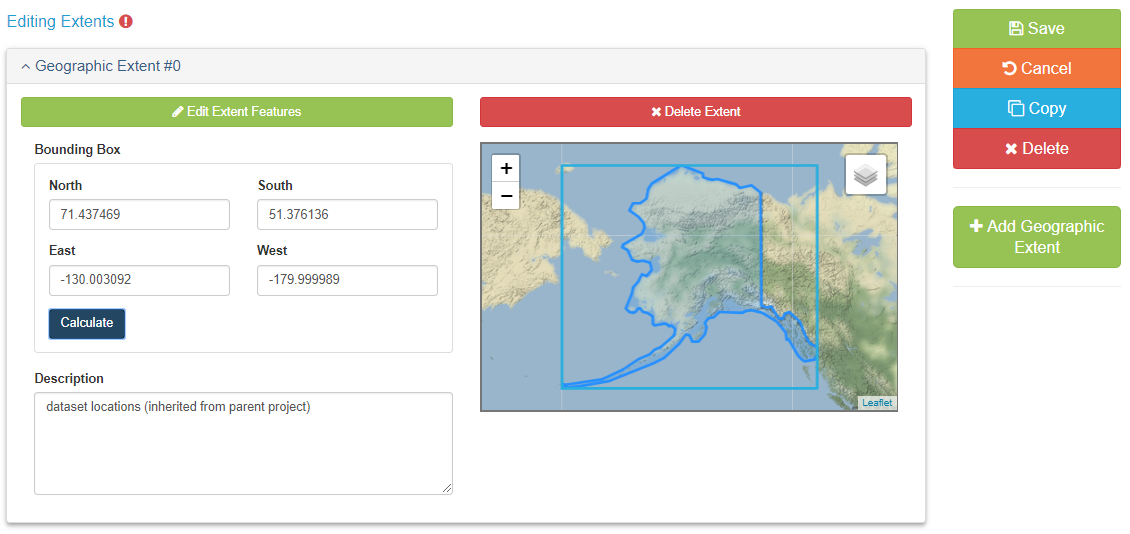
Option 2: Draw Spatial Features
Option 3: Draw Bounding Box
Saving and Exporting Extents